Planning to walk the Yorkshire Wolds Way but drowning in conflicting information about how long it takes, where to stay, and whether you’re actually fit enough? Websites claim it’s “easy” while hiking apps rate it “hard,” guidebooks suggest five days while forums insist on seven, and accommodation options seem randomly scattered with massive gaps in between. The Yorkshire Wolds Way runs from Hessle near the Humber Bridge to Filey on the North Yorkshire coast, crossing gentle chalk hills, serene dry valleys, and peaceful countryside that most hikers completely overlook in favour of the Lake District or Peak District. It earned a Tripadvisor Travellers’ Choice award with 4.9 out of 5 rating, yet remains wonderfully quiet compared to more famous trails.
Whether you’re planning your first long-distance walk, researching how many days you need, trying to work out accommodation logistics, or simply wondering if the Yorkshire Wolds Way deserves your limited holiday time, this guide covers everything. I’ll walk you through realistic daily stages, honest difficulty assessments, section-by-section breakdowns with actual highlights versus official ones, accommodation strategies, what to pack, best times to walk, and why this gentle countryside trail might be exactly what you need. Ready to discover why the Yorkshire Wolds Way is England’s best-kept walking secret? Let’s start with the basics.
- Yorkshire Wolds Way: The Essential Facts
- Planning Your Yorkshire Wolds Way Walk
- Section-by-Section Guide
- Section 1: Hessle to South Cave (11.5 miles / 18.5 km)
- Section 2: South Cave to Market Weighton (12-13 miles / 19-21 km)
- Section 3: Market Weighton to Millington (10-12 miles / 16-19 km)
- Section 4: Millington to Thixendale (13 miles / 21 km)
- Section 5: Thixendale to Wintringham/Weaverthorpe (12-14 miles / 19-22.5 km)
- Section 6: Wintringham/Weaverthorpe to Ganton (13-15 miles / 21-24 km)
- Section 7: Ganton to Filey (10 miles / 16 km)
- Practical Tips
- Why Walk the Yorkshire Wolds Way?
- Frequently Asked Questions
- Conclusion: Is the Yorkshire Wolds Way Worth Walking?
Yorkshire Wolds Way: The Essential Facts
Before diving into detailed sections, let’s cover the fundamentals that actually matter when planning your walk.
Trail Overview
Official Distance: 79 miles (127 km)
Start Point: Hessle Haven, near the Humber Bridge
End Point: Filey Brigg on the North Yorkshire coast
Direction: Usually walked south to north (Hessle to Filey)
Trail Status: National Trail (opened 1982)
Waymarking: Excellent – white acorn symbols throughout
Tripadvisor Rating: 4.9 out of 5 (Travellers’ Choice award)
How Long Does the Yorkshire Wolds Way Take?
This is the most commonly asked question, and the answer is: it depends entirely on your fitness, pace, and how much you want to enjoy versus endure the walk.
Official Recommendation: 5-7 days
Realistic for Most People: 6-7 days
Faster Walkers: 5 days possible
Leisurely Pace: 7-8 days recommended
Record Time: 11 hours, 34 minutes, 31 seconds (Steve Bateson, November 2023, Hardwolds Ultrarun)
I’ve done it in both 6 and 7 days. The 6-day version required some 15-16 mile days that left me exhausted by evening. The 7-day version let me actually enjoy the scenery, stop for proper pub lunches, and not feel like death by day five. Unless you’re seriously fit or have a deadline, give yourself 7 days.
Difficulty Level: What “Moderate” Actually Means
The National Trail describes it as “a gentle, subtle route suitable for almost all abilities” with “no serious hills”. Other sources confirm it’s “not a difficult walk” with “a few short steep sections, but nothing too dramatic”.
But here’s the reality: hiking apps rate it as “hard” covering 83.3 miles with 12,211 feet of elevation gain.
The Truth: The Yorkshire Wolds Way has no brutal climbs or technical terrain. But “gentle” doesn’t mean flat. You’re constantly going up and down chalk hills—individually easy, cumulatively tiring. By day four, those “gentle” slopes feel significantly less gentle.
Honest Difficulty Assessment:
- Terrain: Easy to moderate. Well-maintained paths, clear waymarking, no scrambling
- Elevation: Around 1,900 metres (6,234 feet) total elevation gain spread across 79 miles
- Daily Climbs: Multiple short climbs per day (50-150m typically)
- Fitness Required: Moderate. You should comfortably walk 10-15 miles with a backpack
- Remoteness: Low. Never far from villages or roads
Who It Suits:
- First-time long-distance walkers (genuinely good starter trail)
- People who want beautiful scenery without brutal climbs
- Walkers who prefer quiet trails to crowded ones
- Anyone wanting a proper walk without technical challenges
Who Might Struggle:
- Complete beginners who rarely walk more than 5 miles
- People expecting flat riverside-style walking
- Ultra-fit hikers wanting serious challenges (you’ll be bored)
Best Time to Walk the Yorkshire Wolds Way
According to the National Trail website, May and September are the most popular months, offering fabulous walking weather without peak summer heat or winter mud.
Spring (April-May)
- Pros: Wildflowers, lambs, lighter days, generally dry paths, fewer walkers
- Cons: Can still be cold, occasional rain, some accommodation closed early season
- Best For: Photography, wildlife, avoiding crowds
Summer (June-August)
- Pros: Longest days, warmest weather, all accommodation open, vibrant poppy fields in June/July
- Cons: Can be hot on exposed hilltops, most crowded (though still quiet vs other trails), crops high blocking some views
- Best For: Guaranteed long daylight, warm evenings, maximum facility access
Autumn (September-October)
- Pros: Beautiful colours, harvest time, still warm, fewer people than summer
- Cons: Days shortening, increased chance of rain, muddy after wet spells
- Best For: Stunning autumn colours, comfortable temperatures, relative solitude
Winter (November-March)
- Pros: Empty trails, dramatic winter light, Gypsey Race flowing
- Cons: Short days (problematic for long sections), cold, muddy, limited accommodation, can be bleak
- Best For: Experienced winter walkers only, proper solitude
My Recommendation: Late April/early May or September. You get decent weather, reasonable daylight hours, wildflowers or autumn colours, and fewer people. Avoid July/August unless you love company and don’t mind tourist-season prices.
What Makes the Yorkshire Wolds Way Special?
Fair question. England has dozens of National Trails—why walk this one?
Peaceful: Even in summer, you’ll walk for hours seeing maybe a handful of other walkers. Compare that to the Cotswold Way or Coast to Coast where you’re queuing for photos.
Accessible: Good transport links at both ends, reasonable accommodation options, well-maintained paths, excellent signposting. You can focus on walking rather than expedition logistics.
Varied: Despite being “just” rolling chalk hills, the landscape changes constantly. Dry valleys, open wold tops, wooded sections, historic villages, ancient monuments, and that dramatic finish at Filey Brigg on the coast.
Historic: You’ll pass Wharram Percy (Britain’s most famous deserted medieval village), numerous Iron Age barrows, ancient churches, Roman roads, and villages mentioned in the Domesday Book.
Underrated: Genuinely one of England’s most overlooked National Trails. That means availability, value, and peace—increasingly rare on British walking routes.
Achievable: Not too long, not too hard, but long enough to feel like a proper achievement. Perfect first long-distance trail.
Planning Your Yorkshire Wolds Way Walk
Getting the planning right makes the difference between a brilliant walk and a stressful slog. Let me share what actually works.
How to Break Up the Yorkshire Wolds Way
The standard sections are: 1. Hessle to South Cave, 2. South Cave to Market Weighton, 3. Market Weighton to Millington, 4. Millington to Thixendale, 5. Thixendale to Wintringham, 6. Wintringham to Ganton, 7. Ganton to Filey.
But those official sections don’t always match accommodation availability or sensible daily distances. Here’s my recommended breakdown:
7-Day Itinerary (Recommended)
Day 1: Hessle to South Cave
Distance: 11.5 miles (18.5 km) | Elevation: ~250m
Easy start, breaking yourself in gently. South Cave has good pubs and accommodation.
Day 2: South Cave to Goodmanham/Market Weighton
Distance: 11-13 miles (17.5-21 km) | Elevation: ~300m
Goodmanham offers closer accommodation; Market Weighton has more facilities.
Day 3: Goodmanham/Market Weighton to Millington
Distance: 10-12 miles (16-19 km) | Elevation: ~400m
Beautiful section through Millington Dale. Short day allows afternoon exploring.
Day 4: Millington to Thixendale
Distance: 13 miles (21 km) | Elevation: ~450m
Stunning scenery, proper Wolds walking. Thixendale is remote but magical.
Day 5: Thixendale to Sherburn/Weaverthorpe
Distance: 12-14 miles (19-22.5 km) | Elevation: ~400m
Passes Wharram Percy. Accommodation slightly off-route but necessary.
Day 6: Sherburn/Weaverthorpe to Ganton
Distance: 13-15 miles (21-24 km) | Elevation: ~350m
Longer day but easier terrain as you approach the Vale of Pickering.
Day 7: Ganton to Filey
Distance: 10 miles (16 km) | Elevation: ~200m
Satisfying finish, arriving in Filey with energy to celebrate.
6-Day Itinerary (Faster Option)
Combine days 2-3 or days 5-6 from the 7-day version. Expect 14-16 mile days, which are doable but tiring with a full backpack by day four onwards.
5-Day Itinerary (For Strong Walkers)
Possible but not recommended for first-time long-distance walkers. You’re looking at consistent 15-16+ mile days with no rest day buffer if weather turns bad or you need a break.
Accommodation Strategy
The National Trail website has a downloadable Accommodation & Information Guide, and there are no hostels or bunkbarns on the Yorkshire Wolds Way itself, with the closest being YHA Beverley Friary, about a mile from High Hunsley Beacon.
Accommodation Types:
- B&Bs: Most common option, typically £60-90 per person per night
- Pubs with Rooms: Available in larger villages, around £70-100
- Hotels: Limited, mainly in Market Weighton and Filey, £80-120
- Self-Catering Cottages: Some accept one-night stays, varies widely
- Camping: Very limited official sites directly on route
The Accommodation Challenge:
Not every section has convenient accommodation exactly where you need it. Some solutions:
- Book Early: Popular B&Bs fill up fast, especially May-September. Book 3-6 months ahead if possible.
- Be Flexible: You might need to walk slightly longer/shorter days to match accommodation availability.
- Taxi Options: Some B&Bs slightly off-route offer pick-up/drop-off. Factor in £10-20 extra per day.
- Baggage Transfer: Companies provide baggage transfer services. Worth considering if walking with just a daypack appeals. Costs around £5-8 per bag per day.
- Wild Camping: Technically requires landowner permission. Realistically, some people do it discreetly, but facilities are better than most trails so proper accommodation is feasible.

What to Pack
Essential Kit:
- Boots: Proper walking boots with ankle support. Chalk paths get slippery when wet.
- Waterproofs: Jacket and trousers. Yorkshire weather changes fast.
- Layers: Fleece, base layers, spare socks (multiple pairs)
- Backpack: 40-50L if carrying everything; 20-30L if using baggage transfer
- Water: 2L capacity minimum. Water points are limited on some sections.
- Maps: OS Explorer OL27 and 300 cover the route. Phone battery dies.
- First Aid: Blister kit essential, basic first aid supplies
- Sun Protection: Hat, sunscreen, sunglasses (exposed hilltops)
- Food: Snacks, lunch (not every section has shops/cafés)
- Walking Poles: Optional but helpful on descents
- Head Torch: For early starts or if you’re running late (happens)
Non-Essential But Nice:
- Camera (you’ll regret not bringing one)
- Guidebook (though this guide covers it)
- Kindle/book for evenings
- Small binoculars for wildlife
- Flask for hot drinks on cold days
What to Leave Behind:
- Multiple sets of “evening clothes” (one set is enough)
- “Just in case” items you’ll never use
- Cotton clothing (takes forever to dry)
Costs
Budget Breakdown (Per Person):
Accommodation: £60-90/night × 6-7 nights = £360-630
Food: £25-35/day (breakfast included, pub lunch, dinner) = £150-245
Transport: £30-50 (getting to Hessle, returning from Filey)
Baggage Transfer: £0 (carrying own) or £35-56 (£5-8/day)
Misc: £50-100 (drinks, snacks, emergency supplies, souvenirs)
Total: £590-1,075 per person for 7 days
Walking in pairs/groups reduces per-person accommodation costs significantly. Budget accommodation and packed lunches can bring costs down; boutique B&Bs and restaurant dinners push them up.
Section-by-Section Guide
Now let’s walk through each section properly, with honest assessments of what you’ll actually experience.
Section 1: Hessle to South Cave (11.5 miles / 18.5 km)
Elevation Gain: ~250m
Difficulty: Easy to Moderate
Estimated Time: 4-5 hours
Accommodation: South Cave (good options), Brantingham (limited)
The Start:
Beginning at Hessle Haven beside the mighty Humber Bridge feels appropriately grand. The Humber Bridge is genuinely impressive—Britain’s longest single-span suspension bridge until 1997, still spectacular. Take your “start of walk” photos here.
The Walk:
Due to very high tides dumping considerable amounts of mud onto the path along the Humber Foreshore at North Ferriby Foreshore, walkers are currently recommended to use the alternative High Tide route. Check the National Trail website for current conditions before walking this section.
The trail climbs away from the Humber estuary fairly quickly. You’re heading onto the Wolds proper, and the landscape opens up. Continuing north along Welton Wold, you’ll realise you’re now truly in Yorkshire Wolds country.
The route passes near Brantingham, which for a short deviation is worth visiting for its “lovingly awful” Gothic war memorial built from stones taken from Hull Town Hall.
Highlights:
- Humber Bridge views
- First taste of Wolds hilltops
- Welton Dale woodlands
- Arriving in South Cave feeling like you’ve properly started
Challenges:
- Mud potential on Humber foreshore
- Initial climb sets the pattern for the whole walk
- Finding your walking rhythm with full pack
Facilities: South Cave has good pubs, shops and accommodation as well as public transport back to Hessle or Hull.
My Verdict: A solid start. Not the most dramatic section, but it eases you into the trail without overwhelming you. South Cave makes a comfortable first night.
Section 2: South Cave to Market Weighton (12-13 miles / 19-21 km)
Elevation Gain: ~300m
Difficulty: Moderate
Estimated Time: 5-6 hours
Accommodation: Goodmanham (limited), Market Weighton (good range)
The Walk:
This section takes you deeper into the Wolds, with more pronounced hills and wider views. The chalk landscape becomes more obvious, and you’ll start understanding what makes this area special.
The route passes through or near several small villages, though not all have facilities. Goodmanham village sits closer to the trail than Market Weighton and has some accommodation options.
Highlights:
- Increasingly dramatic Wolds scenery
- Goodmanham (Anglo-Saxon historic site)
- Market Weighton for supplies and proper facilities
- Growing sense of being in genuine countryside
Challenges:
- Longer distance if continuing to Market Weighton
- Accommodation slightly off-route at Goodmanham
- Can feel remote between villages
Facilities:
Market Weighton has shops, cafés, pubs, B&Bs, and the helpful Wolds Way Cafe on Driffield Road. Good place to restock supplies or rest if needed.
My Verdict: This is where the Yorkshire Wolds Way gets properly good. The scenery improves, you’re finding your walking legs, and Market Weighton offers everything you need for a comfortable evening.
Section 3: Market Weighton to Millington (10-12 miles / 16-19 km)
Elevation Gain: ~609m
Difficulty: Moderate to Hard
Estimated Time: 5-5.5 hours
Accommodation: Millington (limited but excellent)
The Walk:
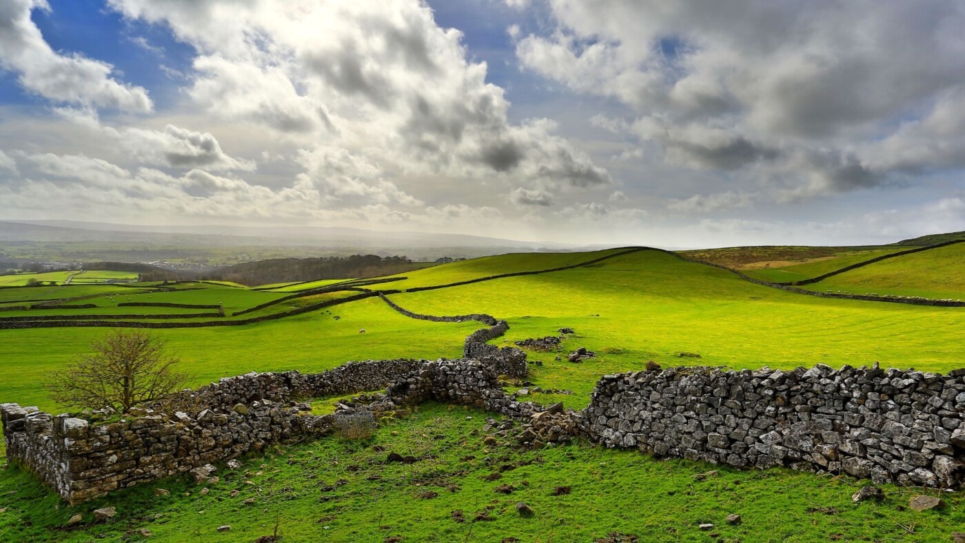
This shorter section packs in some of the best scenery on the entire trail. You’re walking through classic Wolds landscape—rolling chalk hills, dry valleys, and views that go on forever.
Millington sits in a beautiful valley and has inspired artists including David Hockney. The village appeared in several of his Yorkshire paintings, and walking here, you’ll understand why.
Highlights:
- Millington Dale (stunning valley)
- Best views of the entire trail on clear days
- David Hockney painting locations
- The Gait Inn in Millington (excellent pub)
- Arriving early enough to explore the village
Challenges:
- More elevation than previous sections despite shorter distance
- Limited accommodation in Millington (book well ahead)
- Can feel exposed on hilltops in bad weather
Facilities:
Millington has The Gait Inn (food, possible accommodation) and Ramblers Rest tearoom. No shop. This is a tiny village, so don’t expect much beyond beautiful scenery and hospitality.
My Verdict: The landscape feels properly special here, and ending in Millington gives you a genuine sense of being in the heart of the Wolds. The shorter distance means you can enjoy the afternoon rather than collapsing exhausted.

Section 4: Millington to Thixendale (13 miles / 21 km)
Elevation Gain: ~450m
Difficulty: Moderate
Estimated Time: 5.5-6.5 hours
Accommodation: Thixendale (very limited)
The Walk:
This section crosses some of the highest and most remote parts of the Wolds. The landscape feels expansive, and you might walk for hours seeing nobody else. Six dry valleys meet at Thixendale, creating a dramatic natural amphitheatre.
The walking is classic Wolds—up and down gentle chalk hills, through vast open fields, with big skies and wide views. This is proper “escape” territory.
Highlights:
- Remote, peaceful walking
- Highest points on the trail
- Panoramic views on clear days (Vale of Pickering, North York Moors distant)
- Descending into Thixendale’s unique valley setting
- The Cross Keys pub
Challenges:
- Exposed sections with little shelter
- Very limited facilities between villages
- Thixendale accommodation books up fast
- Remote location means taxi back if you need to bail
Facilities:
Thixendale has The Cross Keys pub (food, limited accommodation). No shop. This is about as remote as the trail gets. Beautiful, but be prepared for isolation.
My Verdict: Thixendale is magical. The walk there feels like proper adventure, and arriving in that hidden valley gives you a genuine sense of achievement. Just book accommodation months ahead—there’s not much and it fills fast.
Section 5: Thixendale to Wintringham/Weaverthorpe (12-14 miles / 19-22.5 km)
Elevation Gain: ~400m
Difficulty: Moderate
Estimated Time: 5-6 hours
Accommodation: Weaverthorpe (limited), Sherburn (options), West Lutton (farms)
The Walk:
This section includes one of the trail’s biggest highlights: Wharram Percy, Britain’s most famous deserted medieval village. The ruins sit in a peaceful valley, and you can spend 30 minutes or two hours exploring depending on your interest in history.
Beyond Wharram Percy, the landscape continues rolling and open, gradually transitioning toward the Vale of Pickering.
Highlights:
- Wharram Percy (unmissable, allow time to explore)
- Continued beautiful Wolds scenery
- Sense of walking through layers of history
- Quieter section with fewer walkers
Challenges:
- Accommodation options scattered and not directly on route
- May need to arrange pick-up/drop-off from B&Bs
- Longer distances if continuing to Weaverthorpe
- After Wharram Percy, scenery less dramatic than previous sections
Facilities:
Weaverthorpe has a shop and some accommodation. Sherburn has limited options. This is trickier logistically—plan ahead and confirm accommodation details.
My Verdict: Wharram Percy alone makes this section worthwhile. The accommodation logistics are annoying, but the history and continued beautiful walking justify the effort.
Section 6: Wintringham/Weaverthorpe to Ganton (13-15 miles / 21-24 km)
Elevation Gain: ~350m
Difficulty: Moderate
Estimated Time: 5.5-7 hours
Accommodation: Ganton (limited), Potter Brompton (farms)
The Walk:
The landscape gradually changes as you approach the Vale of Pickering. The dramatic chalk hills soften, and you’re walking through gentler, more agricultural countryside. It feels like you’re transitioning toward the finish.
This section can feel long, especially if you’re tired from previous days. The scenery remains pleasant but less spectacular than the central Wolds sections.
Highlights:
- Easier walking as hills flatten
- Sense of progress toward the coast
- Quiet, agricultural Yorkshire
- Knowing the finish line is close
Challenges:
- Can feel monotonous after dramatic earlier sections
- Longer distances
- Fewer obvious landmarks
- Accumulating fatigue by day six
Facilities:
Ganton has limited accommodation and a pub. Not much else. This is another section where logistics matter more than facilities.
My Verdict: Honestly, this is the least memorable section. It’s fine, perfectly pleasant walking, but after the drama of the central Wolds, it feels a bit anticlimactic. You’re ready for the finish by now.
Section 7: Ganton to Filey (10 miles / 16 km)
Elevation Gain: ~200m
Difficulty: Easy to Moderate
Estimated Time: 4-5 hours
Accommodation: Filey (excellent range)
The Walk:
The final section brings you from the Wolds to the North Sea coast at Filey Brigg. This is where the Yorkshire Wolds Way meets the Cleveland Way, creating a satisfying sense of connection.
The approach to Filey Brigg is dramatic. After 70+ miles of gentle chalk hills, suddenly you’re on coastal cliffs with waves crashing below and seabirds wheeling overhead. It’s a brilliant finish.
Highlights:
- Filey Brigg (spectacular rocky headland)
- First sight and sound of the sea
- Arriving at the coast path
- Sense of achievement completing the trail
- Filey for celebration fish and chips
Challenges:
- Weather can be rough on exposed coastal section
- Busy with day walkers near Filey
- Managing emotions of finishing (yes, really)
Facilities:
Filey is a proper seaside town with everything you need—accommodation, restaurants, shops, pubs, fish and chips, and a train station for getting home.
My Verdict: A perfect finish. That moment when you first see the sea after days of inland walking is genuinely special. Filey Brigg is dramatic, and arriving in Filey gives you a proper Yorkshire coast town to celebrate in.
Practical Tips
Navigation and Waymarking
The Yorkshire Wolds Way is brilliantly waymarked with white acorn symbols. Navigation is pretty straightforward, and the trail is very well signposted like all National Trails.
But bring OS maps anyway. Explorer OL27 (North York Moors Eastern) and Explorer 300 (Howardian Hills & Malton) cover the route. When you’re tired, confused about a junction, or want to identify landmarks, paper maps are gold.
Download offline maps on your phone as backup. Mobile signal is patchy in valleys.
Water and Food
Water points are limited between villages. Carry 2 litres minimum, especially in summer. Some sections have no shops or cafés for 10+ miles.
Pack lunch before leaving each morning. Don’t assume you’ll find somewhere to buy food—you often won’t.
Feet and Blister Management
This is the most important practical advice: look after your feet from day one.
- Break in your boots before the walk (obvious but people ignore this)
- Two pairs of socks work better than one thick pair
- Address hot spots immediately before they become blisters
- Bring multiple plaster types (Compeed, moleskin, fabric plasters)
- Air your feet every evening and let boots dry overnight
- Consider liner socks to reduce friction
Weather and Clothing
Yorkshire weather is famously unpredictable. I’ve had four seasons in one day on the Wolds.
Layering works: Base layer, fleece/insulation layer, waterproof shell. Add or remove as needed.
Chalk paths when wet: Slippery as hell. Proper boots with good grip essential.
Exposed hilltops: Wind can be brutal even when valleys are calm. Always carry windproof layer.
Sun exposure: No shade on open Wolds. Hat, sunscreen, and sunglasses aren’t optional in summer.
Accommodation Reality Check
Book early. Yorkshire Wolds Way accommodation isn’t abundant, and popular B&Bs fill fast.
Confirm arrangements a week before. Small B&Bs sometimes close unexpectedly or forgot they took your booking six months ago.
Get phone numbers for all accommodations. You might need to call if running late or need pick-up.
Baggage Transfer
Companies provide baggage transfer services if you only want that service. It costs around £5-8 per bag per stage.
Walking with just a daypack versus full backpack is a completely different experience. If budget allows, baggage transfer is worth considering, especially for first-time long-distance walkers.
Rest Days
The 7-day itinerary has no rest day built in. Most people push through. But if you’re struggling by day three or four, taking a rest day in Market Weighton or arranging a shorter day isn’t failure—it’s smart.
Transport
Getting to Hessle:
- Train to Hull, then bus to Hessle (regular service)
- Direct trains to Hull from major cities
- Some people arrange drop-off at Hessle Haven
Getting from Filey:
- Direct trains from Filey to Scarborough, York, Leeds, and beyond
- Regular service, easy connections
Circular Options:
- Trains from Filey back to Hull run regularly
- Takes about 1.5-2 hours with one change typically
- Book tickets in advance for cheaper fares
Mobile Signal and Safety
Signal is patchy in valleys and remote sections. Don’t rely on phone for navigation.
Tell someone your itinerary. Check in daily if possible.
Carry emergency contacts for accommodations, taxi numbers, and local information.
The Yorkshire Wolds is safe and well-walked, but basic safety precautions matter.
Money
Not everywhere takes cards, especially small B&Bs and village cafés. Carry cash (£50-100 minimum).
The nearest ATMs might be miles away when you need one. Plan ahead.
What You’ll Actually Think About While Walking
Day 1: “This is beautiful! Why doesn’t everyone walk this trail?”
Day 2: “My feet hurt but this is still great.”
Day 3: “Why are there so many hills? They said gentle.”
Day 4: “I hate walking. Why did I think this was a good idea?”
Day 5: “Okay, I’m getting my second wind. This is good again.”
Day 6: “I’m basically a professional walker now.”
Day 7: “I don’t want this to end. When can I do another long-distance trail?”
Everyone goes through roughly this progression. It’s normal.
Why Walk the Yorkshire Wolds Way?
It’s Achievable: Not too long, not too hard, but long enough to feel like a proper achievement. Perfect first long-distance trail or gateway to longer routes.
It’s Peaceful: Even in peak season, you’ll walk for hours seeing maybe a handful of other people. Compare that to the South West Coast Path or Hadrian’s Wall Path where you’re constantly passing walkers.
It’s Beautiful: The gentle chalk landscape has subtle beauty. It’s not dramatic like the Lake District, but the rolling hills, big skies, and endless views create something special.
It’s Historic: Walking past Iron Age barrows, through deserted medieval villages, along Roman roads, and ending at the coast where Vikings landed centuries ago adds depth to every section.
It’s Manageable: Good accommodation (once booked), clear waymarking, accessible start and finish points, no dangerous sections, and escape routes if needed. You can focus on walking rather than survival.
It’s Overlooked: While other National Trails are crowded and expensive, the Yorkshire Wolds Way remains wonderfully quiet and reasonable. That won’t last forever—walk it while it’s still a secret.
Frequently Asked Questions
Is the Yorkshire Wolds Way suitable for beginners?
Yes, genuinely. This is one of the best first long-distance trails in England. The terrain isn’t technical, navigation is straightforward with excellent waymarking, and the distance is manageable over 6-7 days. You should be able to comfortably walk 10-12 miles with a backpack, but you don’t need mountain experience or advanced hiking skills. I’d recommend it over more challenging trails like the Pennine Way or Coast to Coast for your first long-distance walk.
Can I wild camp on the Yorkshire Wolds Way?
Technically, wild camping in England requires landowner permission. The Yorkshire Wolds is mostly private agricultural land, so permission would be needed. Realistically, some people do camp discreetly (arrive late, leave early, leave no trace), but it’s a grey area legally. Given that accommodation exists along the route and the trail isn’t remote enough to justify wild camping from a safety perspective, I’d recommend proper accommodation or asking farmers directly for permission to camp.
How fit do I need to be?
You should comfortably walk 10-15 miles in a day with a backpack before attempting the Yorkshire Wolds Way. If you’re currently walking 5-6 miles max, build up gradually over 2-3 months before tackling the trail. The cumulative elevation gain (around 1,900 metres total) is significant when spread over multiple days with a pack. Being reasonably fit makes the experience enjoyable rather than an endurance test.
What’s the total elevation gain?
Approximately 1,900 metres (6,234 feet) over the 79 miles. That’s around 270 metres average per day over 7 days, but it’s spread unevenly—some sections have more climbing than others. Individual climbs are rarely more than 100-150 metres, but you’re constantly going up and down chalk hills.
Can I walk it in sections/day walks?
Absolutely. Many people walk the Yorkshire Wolds Way in sections over multiple visits, doing day walks or weekend trips. The National Trail website shows circular routes and linear walks along the trail. This approach lets you enjoy the scenery without committing to the full week-long walk. Good public transport access at both ends and some points along the way makes this feasible.
Is the trail muddy?
After rain, yes—especially the first section along the Humber foreshore and any woodland sections. Chalk paths can be slippery when wet too. In dry summer conditions, it’s generally firm walking. Autumn through spring expect mud on some sections. Gaiters help but aren’t essential. Proper waterproof boots with good ankle support and grip are essential.
Where can I get detailed maps?
OS Explorer maps OL27 (North York Moors Eastern) and 300 (Howardian Hills & Malton) cover the entire route. The National Trail website offers downloadable route maps and a comprehensive Accommodation & Information Guide. The official Aurum Press guidebook by Roger Ratcliffe includes detailed maps and descriptions. OS Maps app lets you download the route for offline use on your phone.
Are there any dangerous sections?
No. The Yorkshire Wolds Way has no dangerous scrambles, exposed ridges, or technical terrain. The coastal cliff section at Filey Brigg requires normal caution (don’t go near the edge), but it’s well-managed with clear paths. The main risks are standard countryside hazards—slippery paths when wet, getting lost if you ignore waymarking, and livestock (cattle/sheep are generally fine but give them space).
Can I take my dog?
Yes, dogs are allowed on the Yorkshire Wolds Way. Keep them on leads near livestock (frequent), and be aware that some sections have stiles rather than gates. The 79 miles over multiple days is a serious commitment for a dog—make sure yours has the fitness and stamina. Check accommodation accepts dogs before booking (many do, sometimes with a supplement).
What about public transport along the route?
Limited. Public transport options are scarce along much of this major national trail between the start at Hessle and finish at Filey. Market Weighton has some bus connections, and Driffield (slightly off-route) has a train station. Most people either walk the full trail over consecutive days or arrange car shuttles/taxis for section walking. The start (Hessle) and finish (Filey) both have good connections.
Is accommodation expensive?
Compared to trails in the Lake District or Cotswolds, the Yorkshire Wolds Way offers reasonable value. Expect £60-90 per person per night for B&Bs, slightly more for hotels. Budget walkers camping or using the occasional budget option can do it cheaper. Luxury seekers will find boutique options at higher prices. Overall, it’s mid-range for UK long-distance trails.
When should I book accommodation?
As early as possible, especially for May-September. Popular spots like Thixendale and Millington have very limited accommodation that books up 3-6 months ahead. Other sections have more options but booking 2-3 months ahead ensures choice. Last-minute bookings in summer are risky—you might end up with expensive taxis to off-route accommodation or no accommodation at all.
Can I walk it north to south (Filey to Hessle)?
Yes, though most people walk south to north. Walking north means finishing at the coast, which feels more satisfying than ending beside a muddy estuary. The prevailing south-westerly winds generally favour northbound walking too. But if logistics work better going south, the trail works fine in either direction.
What if the weather is terrible?
The Yorkshire Wolds offers limited shelter on exposed hilltops. In truly awful weather (heavy rain, high winds), some sections feel miserable. But compared to mountain trails, it’s relatively benign. Good waterproofs, warm layers, and accepting you’ll get wet makes bad weather manageable. If weather is dangerously bad (rare), you’re never far from roads or villages to seek shelter or arrange alternative transport.
How does it compare to other National Trails?
Easier than: Pennine Way, Coast to Coast, South West Coast Path (most sections), Offa’s Dyke Path
Similar difficulty to: Cotswold Way, North Downs Way, Ridgeway
Harder than: Thames Path, Peddars Way, Hadrian’s Wall Path
More peaceful than: Most of the above, especially Cotswold Way and Coast to Coast
Better for first-timers than: Most 100+ mile trails
The Yorkshire Wolds Way offers an excellent middle ground—challenging enough to feel like an achievement without being brutal, long enough to feel like a proper long-distance walk without requiring two weeks off work, and beautiful without being so famous it’s overrun.
Conclusion: Is the Yorkshire Wolds Way Worth Walking?
Walk the Yorkshire Wolds Way if you:
- Want a proper long-distance walking challenge without extreme difficulty
- Appreciate gentle, subtle beauty over dramatic landscapes
- Prefer peaceful trails to crowded ones
- Love history and walking through layers of time
- Need an achievable first long-distance trail
- Want good facilities without full-on tourism infrastructure
- Enjoy English countryside at its most quietly beautiful
Skip the Yorkshire Wolds Way if you:
- Need dramatic mountains and wild scenery
- Want hostel accommodation (there isn’t any directly on route)
- Expect easy riverside-flat walking (it’s not)
- Want lots of fellow walkers for company (you’ll be alone most of the time)
- Need villages with facilities every few miles (gaps exist)
- Prefer shorter trails (79 miles requires commitment)
The Yorkshire Wolds Way isn’t England’s most famous trail. It’s not the most dramatic. It’s not the easiest or the hardest. But it might be the perfect middle-ground trail that offers genuine achievement, beautiful scenery, rich history, and blessed peace.
That 4.9 out of 5 Tripadvisor rating isn’t accidental. People who walk the Yorkshire Wolds Way almost universally love it—often surprising themselves. It’s the trail that exceeds expectations precisely because expectations are moderate.
So is it worth walking? If you want a week of proper Yorkshire countryside, genuinely lovely walking, and the satisfaction of completing a National Trail without it consuming your entire year’s holiday and budget—then yes. Completely worth it.
The Yorkshire Wolds Way is calling. The chalk hills, dry valleys, and peaceful villages are waiting. And that view from Filey Brigg when you finally reach the coast after 79 miles? Absolutely worth every step.
Now stop reading and start planning. Those boots won’t walk themselves.
Ready to explore more of the Yorkshire Wolds?
- Yorkshire Wolds: Complete Guide to East Yorkshire’s Rolling Chalk Hills – Return to main guide
- Yorkshire Wolds Villages and Market Towns: Complete Guide – Where to stay along the route
- Best Walks in the Yorkshire Wolds – Circular walks and day walks
- Kirby Grindalythe: Complete Village Guide – Historic village near the trail
- Where to Stay in the Yorkshire Wolds – Comprehensive accommodation guide
- Triton Inn Sledmere Review
Official Resources:
- Yorkshire Wolds Way National Trail Website – Official route information, maps, and updates
- Natural England – Trail management and conservation information
- Ordnance Survey Maps – Official maps for the route